

Cadastral map in DGN and DXF formats published through e-shop
| Product information | ||
|---|---|---|
 | Name | Cadastral map in DGN and DXF formats published through e-shop |
| Commercial code | 62273 | |
| Export unit | ||
| Unit price | No fees | |
| Export formats | DGN, DXF | |
| Coordinate systems | ETRS89, S-JTSK / Krovak East North | |
| Distribution | 
| |
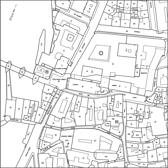
| Product description | Cadastral map is a binding state map series of large scale. Its contents are points of minor horizontal geodetic control, planimetry and map lettering. Vector cadastral map is provided for free in DGN and DXF format. It contains features from Digital cadastral map (DKM) and Digitized cadastral map (KMD), which are geodetic point fields, buildings, boundaries of parcels, cadastral boundaries, cadastral parcels, features of orientation map, boundaries of easements and other features of a map. According to the usage of DGN format, there are no symbols on the lines and arcs are substituted by polylines. To the 2024-08-19, vector map covers 99.09% of the Czech territory, i.e. 78 150.16km2. More: Cadastral Notice No. 357/2013 Sb. as amended. | |
| Update cycle - update state | Pre-defined files are generated from a database, that is updated monthly. | |
| Conditions applying to access and use | https://www.cuzk.cz/English/Practical-Information/Conditions-of-Provision-for-Spatial-Data-and-Netwo/Conditions-for-CUZK-Spatial-Data-Provision.aspx Creative Commons CC BY 4.0 License Public access is not rescticted and is provided in accordance with Decree No. 359/2011 Coll., on the register of territorial identification, addresses and real estates and law 123/1998 Sb., on the right to information about the environment. | |
| View data | ||
| Data download | ||
| Contact - product information | Czech Office for Surveying, Mapping and Cadastre, e-mail: cuzk.helpdesk@cuzk.cz | |
Product last update:
2024-08-23
2024-08-23
Information last update:
2024-08-23
2024-08-23
 RSS 2.0 Geoportal ČÚZK