

Mapa ČR 1:1 000 000 - barevná bezešvá
| Informace o produktu | ||
|---|---|---|
 | Název | Mapa ČR 1:1 000 000 - barevná bezešvá |
| Obchodní kód | 63191 | |
| Výdejní jednotka | stát | |
| Cena za jednotku | Bez poplatků | |
| Výdejní formáty | TIFF | |
| Souřadnicové systémy | S-JTSK / Krovak East North, ETRS89 / UTM zone 33N (N-E) | |
| Distribuce | 


| |
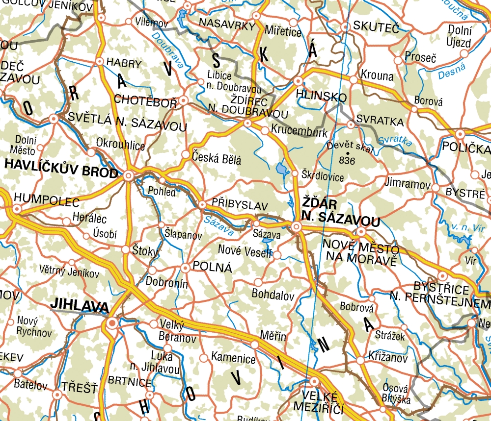
| Popis produktu | Mapa České republiky 1:1 000 000 (MČR 1M) obsahově navazuje na Mapu České republiky 1:500 000 a je rovněž koncipována jako přehledná obecně zeměpisná mapa. Zobrazuje celé území České republiky na jednom mapovém listu. MČR 1M obsahuje polohopis, výškopis, zeměpisnou síť, popis a vysvětlivky k mapě. Předmětem polohopisu jsou sídla, komunikace (dálnice, silnice, železnice), vodstvo (významné vodní toky a nádrže), hranice státní a krajské, porost a povrch půdy (lesy). Předmětem výškopisu jsou výškové body. Popis mapy sestává ze standardizovaného geografického názvosloví, názvu a měřítka mapy s tirážními údaji a údaji grafického měřítka, textové části vysvětlivek a rámových údajů (zeměpisné souřadnice). Předměty obsahu mapy jsou souvisle znázorněny i na přiléhajících částech území sousedních států. Souborová data jsou poskytována ve formátu TIFF a doplněna o TFW soubory pro souřadnicové systémy S-JTSK a ETRS89-TM33N. | |
| Aktualizační cyklus - stav aktualizace | Poslední vydání této mapy je z roku 2021. | |
| Podmínky přístupu a použití | Bez poplatků Licence Creative Commons CC BY 4.0 Dle Vyhlášky č. 31/1995 Sb. | |
| Prohlížení dat |
Mapová aplikace Služba WMS | |
| Stahování dat |
Služba Atom Export výřezu dat Stažení předpřipravených souborů - výběr nad mapou | |
| Kontakt - informace o produktu | Zeměměřický úřad, e-mail: ZU-obchod@cuzk.cz | |
Poslední aktualizace produktu:
2021-12-31
2021-12-31
Poslední aktualizace/revize informací:
2024-01-23
2024-01-23
 RSS 2.0 Geoportál ČÚZK