

Base map of the Czech Republic 1:25,000
| Product information | ||
|---|---|---|
 | Name | Base map of the Czech Republic 1:25,000 |
| Commercial code | 63223 | |
| Export unit | ZM 25 map sheet (113 km2) | |
| Unit price | Pricelist of products and services | |
| Export formats | TISK | |
| Coordinate systems | S-JTSK / Krovak East North, ETRS89 (geographic 2D) | |
| Distribution | 
| |
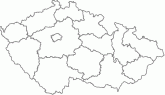
| Product description | Base map of the Czech Republic 1:25,000 (ZM 25) is part of the national map series. The map is derived from Base map of the Czech Republic 1:10,000 (ZM 10). It is conceived as a general geographical map of medium scale, ie a topographical map. The territory of the Czech Republic is captured in a continuous map layout on 773 map sheets. The dimensions of paper of the map are 62 x 46 cm, the map face, which in average shows an area of 113 km2, has a trapezoidal shape with a height of 38 cm and a length of bases from 47.03 to 49.22 cm. The map is continuously published since 1971 and the first edition of the map was completed in 1995. Dimensions and designation of ZM 25 are derived from map sheet of Base Map of the Czech Republic 1:50 000 by dividing into four parts. The name of the map sheet is usually the same as the name of the largest place (by population) displayed on the map sheet. ZM 25 contains planimetry, altimetry and map lettering. The subjects of planimetry are settlements and individual objects, roads, hydrography, boundaries of administration units and boundaries of cadastre units (including technical units of territory), boundaries of protected areas, vegetation and surface of the land. The subject of altimetry is terrain relief displayed by contours and hachuring. The contour interval is 5 m. Map lettering consists of names of objects, contour values, spot heights, standardized geographical names, frame and marginal informations. The subjects of the map are shown only in the territory of the Czech Republic. The map sheets issued since 1993 contain planar rectangular grid by 1 km (S- JTSK) and geographical graticule (ETRS89). ZM 25 has been processing by digital technology using Fundamental Base of Geographic Data of the Czech Republic - ZABAGED ® and Database of geographic names of the Czech Republic Geonames. New form of ZM 25 was completed for the entire territory of the Czech Republic in 2009. | |
| Update cycle - update state | Czech Office for Surveying, Mapping and Cadastre Update state | |
| Conditions applying to access and use | Terms of trade Charging according to Pricelist of products and services | |
| View data |
Web map application | |
| Data download | ||
| Contact - product information | Czech Office for Surveying, Mapping and Cadastre, e-mail: premysl.jindrak@cuzk.cz | |
Product last update:
2019-12-31
2019-12-31
Information last update:
2023-01-31
2023-01-31
 RSS 2.0 Geoportal ČÚZK