

Prohlížecí služba WMS - Klady mapových listů
| Informace o produktu | ||
|---|---|---|
| Název | Prohlížecí služba WMS - Klady mapových listů | |
| Obchodní kód | Obchodní kód není stanoven | |
| Výdejní jednotka | Výdejní jednotka není stanovena | |
| Cena za jednotku | ||
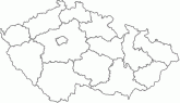
| Popis produktu | Prohlížecí služba WMS-KLADY je poskytována jako veřejná prohlížecí služba nad vektorovými daty kladů listů Základních map ČR středních měřítek a Ortofota ČR. Slouží především pro orientaci v dělení těchto produktů na jednotlivé výdejní jednotky. Služba splňuje standard OGC WMS 1.1.1. a 1.3.0. | |
| Vlastnosti služby | ||
| Lokalizace služby | https://ags.cuzk.gov.cz/arcgis/services/KladyMapovychListu/MapServer/WmsServer? | |
| Omezení a podmínky přístupu a použití | Zásady užívání dat a služeb ZÚ | |
| Prohlížení služby ve veřejném klientu |
Spustit službu | |
| Kontakt | Český úřad zeměměřický a katastrální, Srovnal Pavel, Mgr. , tel: +420 585 552 410 , e-mail: pavel.srovnal@cuzk.gov.cz | |
Poslední aktualizace produktu:
2023-01-06
2023-01-06
Poslední aktualizace informací:
2025-03-06
2025-03-06
 RSS 2.0 Geoportál ČÚZK