

State Map 1:5000
| Product information | ||
|---|---|---|
 | Name | State Map 1:5000 |
| Commercial code | 63815 | |
| Export unit | SM 5 map sheet (2,5x2 km) | |
| Unit price | According to Regulation No 645/2004 Sb. | |
| Export formats | JPEG | |
| Coordinate systems | S-JTSK / Krovak East North | |
| Distribution | 

| |
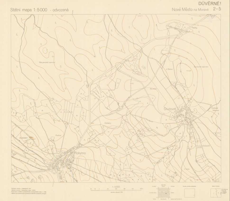
| Product description | The State Map 1:5 000-derived, published continuously since 1950, was originally intended as a provisional arrangement. For the first editon, the planimetry was derived from cadastral maps and altimetry from the most suitable existing backgrounds, e.g. from the topographic maps in the S-1952 datum, if necessary even from topographic sections of the 3rd military mapping. The planimetry contained settlements, transport network, waters, forests, adniministrative boundaries and topographic details as bridges, devotional pillars, statues, chimneys, towers etc. using the map symbols in grey. The altimetry was represented by contour lines depending on used altimetric bacgrounds, spot heights and, as necessary, by technical or topograhical hachures including the map lettering in brown. The graphic design of the map frame differed at the time: for the first edition scale lines of planimetric net of Křovák´s univers conform conic projection coordinates are signalized on the simple linear frame in a half-kilometer interval. Up to 1990 these maps were not intended for the public and could have been used only for internal need of state bodies and socialistic organisations. | |
| Update cycle - update state | After scanning of the whole data series the update is further terminated; it is an archival document that is not a subject of update. | |
| Conditions applying to access and use | According to Regulation No 645/2004 Sb. | |
| View data |
Web map application | |
| Data download | ||
| Contact - product information | Land Survey Office, e-mail: ZU-obchod@cuzk.gov.cz | |
Product last update:
2020-01-24
2020-01-24
Information last update:
2025-03-06
2025-03-06
 RSS 2.0 Geoportal ČÚZK