

Digital geographical model of territory of the Czech Republic (Data250)
| Product information | ||
|---|---|---|
 | Name | Digital geographical model of territory of the Czech Republic (Data250) |
| Commercial code | Commercial code is not defined | |
| Export unit | Czech Republic | |
| Unit price | No charges | |
| Export formats | SHP | |
| Coordinate systems | S-JTSK / Krovak East North, ETRS89 / UTM zone 33N (N-E) | |
| Distribution | 


| |
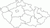
| Product description | The Data250 database is a digital geographic model of the territory of the Czech Republic corresponding to the accuracy and degree of generalization of the scale 1:250,000. Data250 is processed in the scope of the entire territory of the Czech Republic, it was created by generalization of the original Data200 database in 2023. The minimum positional accuracy is 125 m. The content of Data250 consists of approx. 50 types of geographic objects. The database is structured into eight thematic groups - administrative boundaries, leadership, transport, settlements, description, various objects, vegetation and soil surface, altimetry. | |
| Update cycle - update state | Whole dataset is updated once a year. Information about recency of individual features see the document Katalog Data250. Update state | |
| Conditions applying to access and use | No charges Creative Commons CC BY 4.0 License According to Regulation No 31/1995 Sb. | |
| View data |
Web map application WMS service | |
| Data download |
Data download from a directory - S-JTSK
Data download from a directory - ETRS89/TM33N Atom service Export of a current extent Pre-defined files download - selection above the map WFS service | |
| Contact - product information | Land Survey Office, e-mail: ZU-obchod@cuzk.cz | |
Product last update:
2024-05-13
2024-05-13
Information last update:
2024-05-17
2024-05-17
 RSS 2.0 Geoportal ČÚZK