- ZABAGED - HOME PAGE
- Introduction
- 1. Settlement, economic and cultural features
-
2. Transport infrastructure
- 2.01 ROAD, MOTORWAY
- 2.02 STREET
- 2.03 CART TRACK
- 2.04 TRAIL
- 2.05 NON-LEVEL CROSSING
- 2.06 UBU LEVEL CROSSING
- 2.07 ROAD NETWORK NODAL POINT (OTHER)
- 2.08 BRIDGE
- 2.09 FOOTBRIDGE
- 2.10 UNDERPASS
- 2.11 LEVEL RAILWAY CROSSING
- 2.12 CULVERT
- 2.13 FERRY
- 2.14 TUNNEL
- 2.15 PARKING, REST AREA
- 2.16 BORDER CROSSING, CONNECTION ACROSS THE BORDER
- 2.17 RAILWAY TRACK
- 2.18 RAILWAY SIDING
- 2.19 RAILWAY YARD
- 2.20 RAILWAY STATION, RAILWAY STOP
- 2.21 METRO STATION
- 2.22 CABLEWAY, SKI LIFT
- 2.23 CABLEWAY PYLON
- 2.24 TRAMWAY
- 2.25 AIRPORT
- 2.26 AIRPORT RUNWAY PERIMETER
- 2.27 AIRPORT RUNWAY AXIS
- 2.28 METRO
- 2.29 SQUARE DEFINITION POINT
- 2.30 FORD
- 2.31 UNREGISTERED ROAD
- 2.32 ROAD IN CONSTRUCTION
- 2.33 AREA OF RAILWAY STATION, STOP
- 2.34 HELIPORT, HELIPAD
- 2.35 RAILWAY TURNTABLE, TRAVERSER
- 2.36 BARRIER
- 2.37 TOURIST HIKING TRAIL
- 3. Distribution networks and pipelines
- 4. Waters
- 5. Territorial units, including protected areas
- 6. Vegetation and grounds
- 7. Terrain relief
- 8. Survey control points
- OVERVIEW OF CHANGES
| Feature category: | 2. Transport infrastructure |
| Feature type: (with ordinal number) |
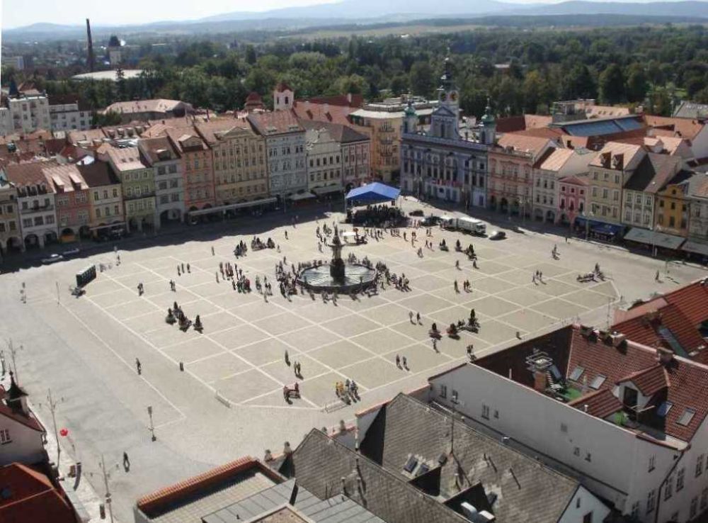
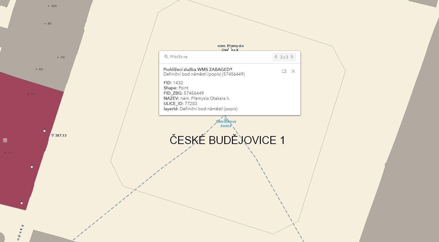
2.29 SQUARE DEFINITION POINT (DEFINIČNÍ BOD NÁMĚSTÍ) |
| Feature type code: | al170 |
|
Feature definition: The point to which the name of a square or the name of such a public space is related, the location of which cannot be or is not suitable expressed by the street axis (AP002). |
| Geometric determination of the feature: | point |
| Positional accuracy: | - |
| Geometric data source: | orthophoto, field recognition |
| Descriptive data source: | municipality |
| A t t r i b u t e s : |
| Attribute name | Data type | Attribute subject | Attribute values | Code list |
| NAZEV | VARCHAR2(50) | name of square | ||
| ULICE_ID | NUMBER(7,0) | identifier of square or public space according to RÚIAN | ||
| FID_ZBG | VARCHAR2(40) | unique feature identifier in ZABAGED® |
| S i z e r e s t r i c t i o n s : |
| without restriction |
| E x a m p l e s : |
|
| F e a t u r e h i s t o r y : |
Extended web version updated to: 01.01.2026
Contact: Content Guarantor: Petr Neckář (e-mail: Petr.Neckar@cuzk.gov.cz; tel: +420 284 041 667)
Content Filling: Marek.Popp@cuzk.gov.cz | Technical Solution: Antonin.Baco@cuzk.gov.cz, Petr.Cerveny@cuzk.gov.cz
Contact: Content Guarantor: Petr Neckář (e-mail: Petr.Neckar@cuzk.gov.cz; tel: +420 284 041 667)
Content Filling: Marek.Popp@cuzk.gov.cz | Technical Solution: Antonin.Baco@cuzk.gov.cz, Petr.Cerveny@cuzk.gov.cz