- ZABAGED - HOME PAGE
- Introduction
- 1. Settlement, economic and cultural features
- 2. Transport infrastructure
- 3. Distribution networks and pipelines
- 4. Waters
- 5. Territorial units, including protected areas
-
6. Vegetation and grounds
- 6.01 LAND USE BOUNDARY
- attributes:
- FID_ZBG
- 6.02 ARABLE LAND AND OTHER UNSPECIFIED GROUNDS
- 6.03 HOP-FIELD
- 6.04 ORCHARD, GARDEN
- 6.05 VINEYARD
- 6.06 PERMANENT GRASSLAND
- 6.07 FOREST GROUND WITH TREES
- 6.08 FOREST GROUND WITH SHRUBBERY
- 6.09 FOREST GROUND WITH MOUNTAIN PINE
- 6.10 MAINTAINED GREENERY
- 6.11 SIGNIFICANT OR LONELY TREE, GROVE
- 6.12 LINE VEGETATION
- 6.13 FOREST BREAK
- 6.14 PEATBOG
- 6.15 AUXILIARY LAND USE BOUNDARY
- 6.16 FOREST GROUND WITH TREES CATEGORIZED
- 6.01 LAND USE BOUNDARY
- 7. Terrain relief
- 8. Survey control points
- OVERVIEW OF CHANGES
| Feature category: | 6. Vegetation and grounds |
| Feature type: (with ordinal number) |
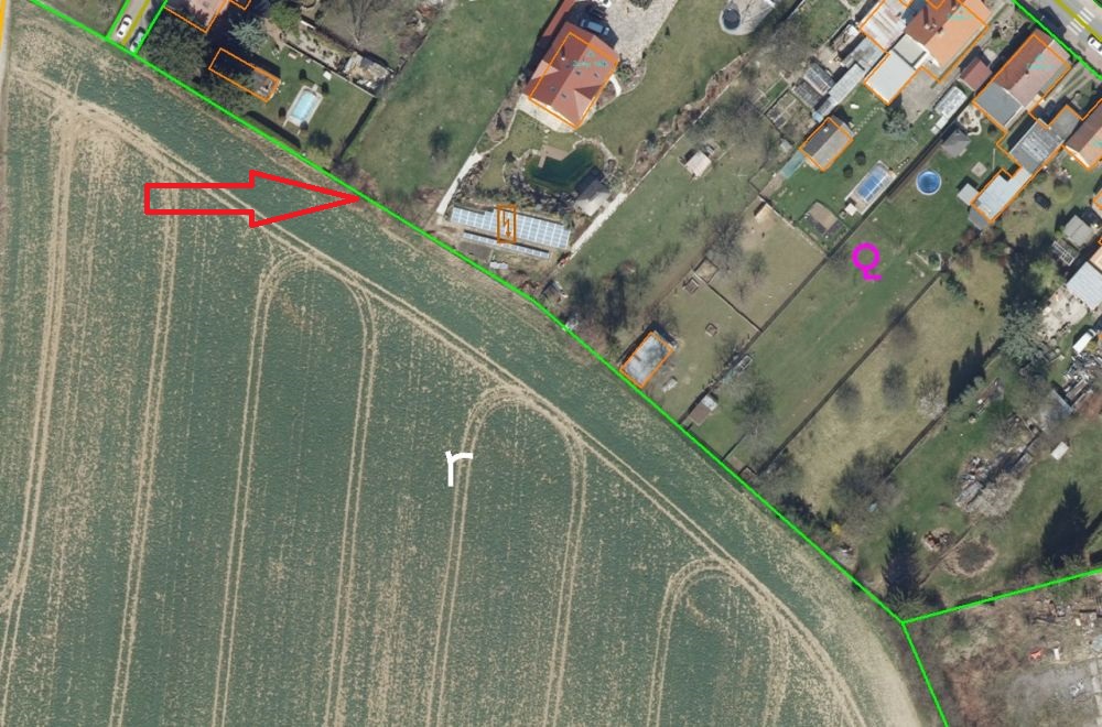
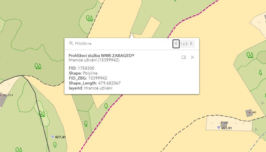
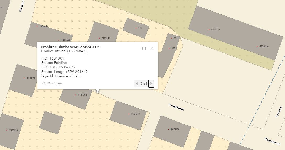
6.01 LAND USE BOUNDARY (HRANICE UŽÍVÁNÍ PŮDY) |
| Feature type code: | ex100 |
|
Feature definition: Lines separating different types of land cover and land use. |
| Geometric determination of the feature: | line |
| Positional accuracy: | mp = 2,0 m |
| Geometric data source: | aerial survey photos, orthophoto, field recognition, LPIS |
| Descriptive data source: | - |
| A t t r i b u t e s : |
| Attribute name | Data type | Attribute subject | Attribute values | Code list |
| FID_ZBG | VARCHAR2(40) | unique feature identifier in ZABAGED® |
| S i z e r e s t r i c t i o n s : |
| without restriction |
| E x a m p l e s : |
|
| F e a t u r e h i s t o r y : |
Extended web version updated to: 01.07.2026
Contact: Content Guarantor: Petr Neckář (e-mail: Petr.Neckar@cuzk.gov.cz; tel: +420 284 041 667)
Content Filling: Marek.Popp@cuzk.gov.cz | Technical Solution: Antonin.Baco@cuzk.gov.cz, Petr.Cerveny@cuzk.gov.cz
Contact: Content Guarantor: Petr Neckář (e-mail: Petr.Neckar@cuzk.gov.cz; tel: +420 284 041 667)
Content Filling: Marek.Popp@cuzk.gov.cz | Technical Solution: Antonin.Baco@cuzk.gov.cz, Petr.Cerveny@cuzk.gov.cz